Rising sea levels visibly transforming parts of coastal region around Kakadu National Park
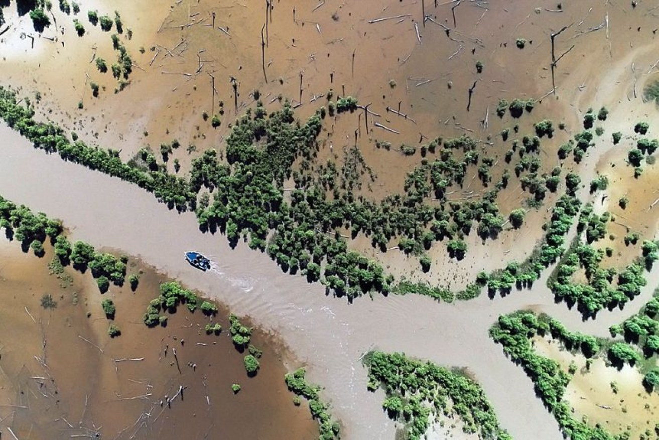
Tommycut Creek gives a glimpse into the future for similar low-lying coastal areas. Photo: ABC News
Floodplains around Australia’s largest national park are undergoing a visible transformation as rising sea levels push salt water further from the coast into its freshwater river systems.
Climate change is understood to be driving the phenomenon along the coastal region around Kakadu National Park in the Northern Territory, which will likely have dramatic consequences in the coming century.
If emissions continue to rise, modelling by the CSIRO from 2017 shows almost half of Kakadu’s freshwater wetlands could be inundated with saltwater within 50 years, spelling out drastic repercussions for biodiversity.
Due to a process that began decades ago, evidence of saltwater inundation is plain to see in areas of the park and beyond, where mangroves – shrubs that thrives in brackish water – have taken over as far as the eye can see.
At Tommycut Creek, a remote channel off the Mary River near Kakadu’s western boundary, what was once a paperbark forest is now a graveyard of bleached and stricken trunks.
The “dead forest” offers a glimpse into the future for similar low-lying coastal areas along the Top End coast, which are most vulnerable to rising sea levels.
By 2132 the CSIRO’s modelling predicts Kakadu’s freshwater floodplains could be entirely affected by a rising tide of seawater.
“Each year that tree line of mangroves keeps pushing further and further up into the dead forest,” said Chris Mills, a local guide who has fished the Mary River for barramundi since his childhood.
“Eventually it’s just going to become a saltwater habitat.”
‘It could be grim’
On a high tide, Mr Mills can steer his boat among the towering stalks of Tommycut Creek, but mangroves are beginning to block his path.
Another narrow waterway that for years served as a shortcut for many anglers known as The Cutting is now impassable.
To slow the rising tide of seawater, a network of mud barriers called barrages were installed by the Northern Territory Government in the 1980s.
In 2019 a report commissioned by the NT government found barrages had a negative impact on the environment – causing soil damage, erosion and sedimentation – and could no longer hold back the tide.
“The effectiveness of barrages reduce over time as sea level rise and climate change, i.e. extreme weather events, continue to impact the Top End,” a government spokesperson said.
The same year the report was released, the Mary River saltwater intrusion program was axed as part of the NT government budget repair, a government spokesperson said.

The Mary River in the NT on Kakadu’s western edge. Photo: ABC News/Rhiannon Stevens
The ecological changes now being seen in the Kakadu region have long been predicted by climate modelling, said Professor Lindsay Hutley, an environmental scientist from Charles Darwin University.
“Changes are afoot, and we’re starting to see them manifesting themselves around Australia in terms of ecosystem failure.”
The unique topography of the Top End means sea levels are rising there at more than double the global average.
While the long-term impacts of sea level rise are hard to predict, on Kakadu’s floodplains “it’ll probably happen fairly quickly”, Professor Hutley said. “It could be grim.”

Hundreds of birds and thousands of plant species call Kakadu National Park home. Photo: ABC News/ Tom Joyner
Will Kakadu be unrecognisable?
Ranger and traditional owner Simon Mudjandi has heard stories of sea level rise and its effects on the region from elders since he was young.
“It’s like acid eating something up,” he said.
Covering roughly two million hectares east of Darwin, Kakadu National Park is a World Heritage listed area.
Hundreds of birds and thousands of plant species call it home and it has been a place of great Aboriginal cultural importance for tens of thousands of years.
A member of the park’s Indigenous ranger program, Mr Mudjandi spends his days travelling the region, monitoring sites and working on conservation projects.
He is concerned the park won’t be accessible for future generations of traditional owners.
“Kakadu is really important to me and my family because the park has a lot of sacred sites and it has stories as well,” he said.

Chris Mills hopes the wildlife and fish the Mary River is famous for will be here for generations to come. Photo: ABC News/Tom Joyner
A spokesman for Parks Australia said it was working with traditional owners to mitigate the impact of climate change in Kakadu and its climate change strategy was currently being updated.
Despite the gradual transformation of the river systems in the Kakadu region, fishing guide Chris Mills wants his future grandchildren to experience the park too.
“Hopefully, it’s still got the floodplains, the wildlife,” he said.
“It will still be an amazing fishery and people will travel from a long way to come and see it.”
–ABC


‘Electric’ Melania makes campaign cameo