Archaeologists to plumb depths of Mayan pyramid in search of ‘elaborate underworld’
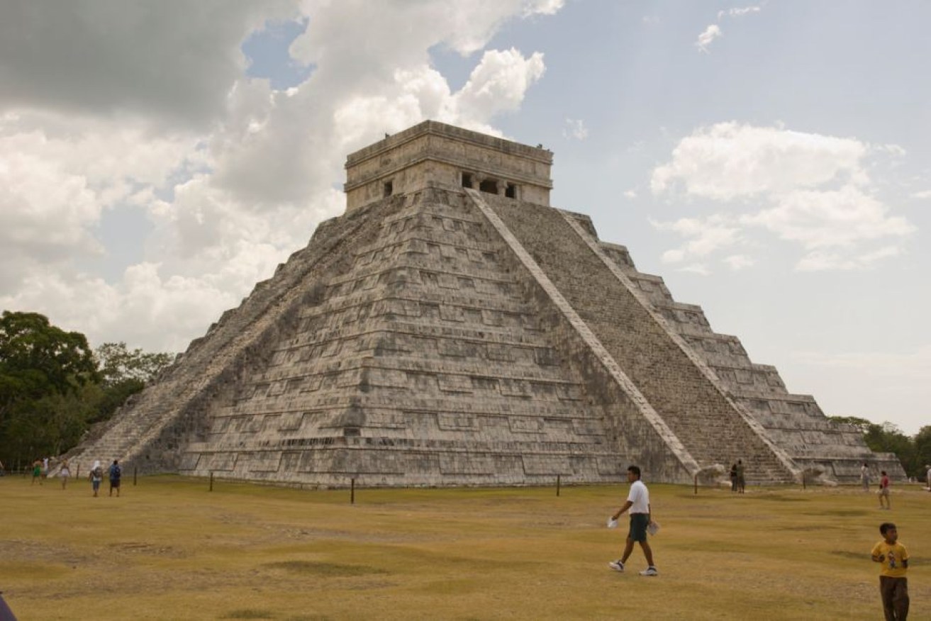
What lies below? El Castillo, or "The Castle" at Chichen Itza in Mexico. Photo: Flickr: Nikonian Novice
Archaeologists are set to explore the ancient Mayan Temple of Kukulkan and the ruins of Chichen Itza like never before, using a specially-modified radar to hunt for hidden passages, rooms and caves, according to National Geographic.
The step-pyramid, also known as El Castillo and built more than 1000 years ago in Mexico, has long been explored by adventurers and archaeologists – but this will be the first comprehensive investigation of the site in 50 years.
A modified ground-penetrating radar (GPR) will be used to locate passageways and rooms in El Castillo without causing any damage, and the team of scientists will use the radar to search the surrounding area of Chichen Itza for tunnels and caves.
Researchers will also use kayak-mounted sonar to explore the naturally-occurring sinkholes that dot the landscape, hoping to identify connections between underground water systems spoken of in Mayan oral history.
“Something on this scale has never been attempted, but we’re confident that it will help us understand this site in a way that wasn’t possible before,” Guillermo de Anda, an underwater archaeologist with Mexico’s National Institute of Anthropology and History and director of the Great Maya Aquifer Project, told National Geographic.
“With this data, I believe we will conclusively find out if the local legends of an elaborate underworld are true.”

A diver explore Cenote Holtun, one of the many sinkholes that dot the Chichen Itza area. Photo: AAP
Those legends hint at a watery labyrinth beneath the great pyramid, and archaeologists also suspect there are hidden chambers in the heart of El Castillo.
The Mayans believed the sinkholes, called cenotes, were thresholds to the realm of the gods, Dr de Anda said.
The researchers are hoping laser-scanning technology and photogrammetry will help them create an accurate three-dimensional map of the area.
“In the end, we’ll be able to combine data from these imaging tools and produce a millimetre-scale, 3D ‘super map’ of the entire site, above and below the ground,” National Geographic engineer Corey Jaskolski said.
In the first week of sonar-scanning, researchers discovered two submerged caves and several dry ones, one of which contained a stone carving of a female, and Mr Jaskolski said initial GPR scans had already indicated “a number of anomalies” behind the walls of the temple and below of the floor of the Red Jaguar throne in the inner chamber.
“We need to wait for the data to be processed to have a better interpretation of what it all means,” Mr Jaskolski said.
“But I believe that this approach will tell us much more about the structure of the pyramid and what may be hidden behind its inner walls.”


Thousands flee Indonesian volcano