Driving rain puts southern NSW on high flood alert as rivers peak
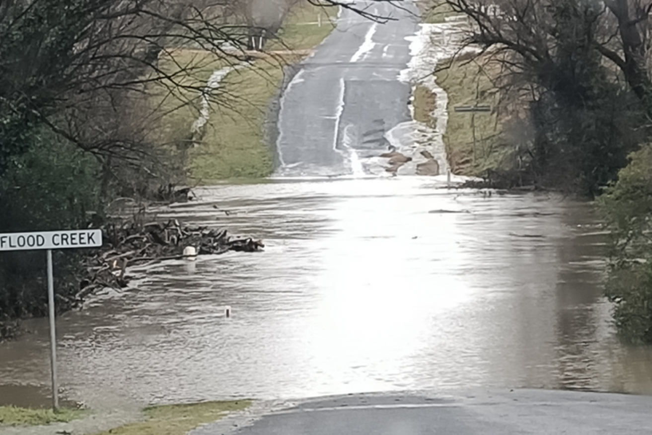
This aptly named watercourse near Braidwood was a mere trickle before the rains pelted down. Photo: Twitter
Heavy rainfall has caused flash flooding in NSW’s South Coast region with concerns some river levels could peak, further saturating some communities.
Up to 200 millimetres of rainfall hit a number of towns including Moruya, Nowra and Captains Flat over the past 24 hours, with up to 300mm of rain falling in some areas.
More than 20 homes at Broughton Vale near Berry were also cut off by floodwater.
There are concerns about the town of Moruya where the river is expected to peak at 2.7 metres on Sunday afternoon as well as Sussex Inlet which is forecast to rise to 1.3m with the high tide at night.
The nearby river at Island Point Road is also expected to peak near 1.5m later on Sunday.
https://twitter.com/NSWSES/status/1292323607117324288
The NSW State Emergency Service says the ground in those areas is already very saturated after heavy rainfalls caused flash flooding one week ago.
Commissioner Carlene York says volunteers are closely watching the flooding in Moruya’s CBD with residents urged to prepare their properties in case an evacuation is ordered.
“Moruya CBD is our greatest risk at this stage and those areas affected from a week ago around the Sussex Inlet areas,” she told reporters in Sydney on Sunday.
“The ground is pretty well saturated in these areas, it does make it very difficult for these waters to get away and does result in that flash flooding sometimes in unexpected areas that have not flooded before.”
Ms York also noted the ground across parts of the South Coast has become unstable as a result of last summer’s bushfires with residents warned to be alert for landslides and fallen trees.
No it’s not a Loch Ness monster, it’s one of thousands of logs hurtling down a swollen Molonglo River near its confluence with the Queanbeyan River. All the water and debris is heading into an overflowing Lake Burley Griffin @canberratimes pic.twitter.com/VyFrMBrIyc
— Tim the Yowie Man (@TimYowie) August 9, 2020
The NSW SES has responded to more than 700 calls for help and conducted more than 18 flood rescues over the past 48 hours with most calls coming from Berry, Nowra, Broughton Vale and Gerringong.
NSW Bureau of Meteorology senior flood hydrologist Justin Robinson said the heavy rains are expected to ease on the South Coast later on Sunday and move towards Sydney, the Central Coast and possibly into the Hunter region.
“Hopefully over the next 24 hours the worst of the weather will be over,” he told reporters.
The bureau remains “very concerned” about South Coast communities including Nowra where river levels are still rising.
“This is a pretty big flood for those communities impacted,” he said.
Flood warnings associated with the low-pressure system have been issued for the Shoalhaven, St Georges Basin, Deua, Moruya, Queanbeyan, Molonglo and Snowy rivers.
Severe weather warnings have been issued on Sunday for a large stretch of the NSW coast from Moruya to Kempsey, taking in Wollongong, Sydney and Newcastle. Heavy rainfall, damaging winds and very heavy surf are expected.

This home’s front yard is now a lake. Photo: Twitter
“Residents are waking up to a changing landscape,” NSW State Emergency Service deputy incident controller Allan Budziarski said in a statement on Sunday.
“We remind everyone, whether you are a local or just passing through, never walk, ride, drive or play in floodwaters.”
Disaster assistance has been made available to those impacted in the local government areas of Bega Valley, Eurobodalla, Kiama, Shellharbour, Shoalhaven and Newcastle.
The NSW SES encourages those dealing with the heavy rainfall to move vehicles under cover, secure loose items around their homes and keep at least eight metres away from fallen power lines.
-AAP