Hundreds of kilometres under Tropical Cyclone Megan warning
Source: Bureau of Meteorology
Tropical Cyclone Megan is affecting the Northern Territory coast as a category three system with concerns it could intensify, bringing 200km/h winds and hundreds of millimetres of rainfall.
The weather system intensified to a category three on Sunday with the Bureau of Meteorology warning there was a 20 per cent chance of it developing into a category four by Monday night.
“Severe Tropical Cyclone Megan is beginning to impact the southwestern Gulf of Carpentaria coast,” the Bureau of Meteorology advised at 8pm (ACST) on Sunday.
The cyclone is forecast to hit the NT coast on Monday night with a warning area spanning hundreds of kilometres – from Alyangula on Groote Eylandt in the NT to the Queensland border and inland to Borroloola, the McArthur River Mine and Robinson River.
Tweet from @BOM_au
“There is a moderate chance that this system could develop into a category four tropical cyclone,” the bureau’s Shenagh Gamble said on Sunday.
The core of the cyclone has been called destructive, bringing wind gusts of up to 220km/h and rainfall totals of 300-400 millimetres.
Gamble said the cyclone would likely remain a category three when it made landfall on Monday night but could intensify if it slowed down before then.
Possible rainfall totals of between 150 and 200 millimetres and wind gusts of up to 110km/h were forecast in the other hundreds of kilometres of warning zone and dozens of towns.
There are flood watches for the Carpentaria to Arnhem and Barkly. The weather bureau said the flood warnings could expand as the cyclone hit the coast.
It might already be too late for some residents to leave as the cyclone approaches.
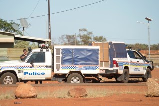
“When the tropical cyclone does arrive, we need you to take shelter inside,” NT Police Superintendent Sonia Kennon said on Sunday.
“Stay indoors until all clear is given by the authorities.”
The weather system is expected to return to a tropical low as it heads further inland on Tuesday and Wednesday.
“We expect it to maintain tropical cyclone intensity all the way through to Borroloola and even to McArthur River Mine,” Gamble said.
Once it reaches land, Megan is forecast to weaken and track west through the NT as a tropical low.
Megan has formed a month after category one ex-tropical Cyclone Lincoln crossed the territory’s coast in the southern Gulf of Carpentaria, bringing high winds and heavy rainfall.
-AAP