Planning a picnic? This online tool shows where your travel bubble overlaps with friends

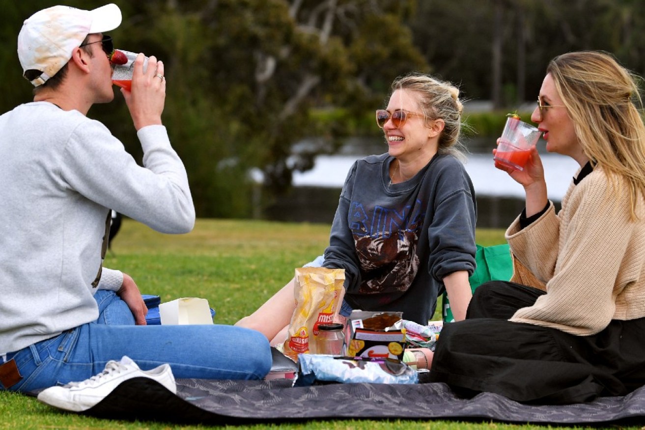
A new online application helps you work out where you can have a picnic without breaking COVID restrictions. Photo: AAP
More than 10,000 Australians living under lockdowns have turned to a new online tool to plan picnics with friends in line with easing government restrictions.
Friendship Island launched last week to help Sydneysiders work out if their five-kilometre travel radius overlaps with that of their friends, and in response to popular demand, a Victorian version was rolled out on Monday afternoon with a 10-kilometre travel radius.
The tool’s creator, digital cartographer Stella Blake-Kelly, said the lightbulb moment came when she realised the official NSW government map only allowed her to look up one address at a time.
“I made a map for some friends illustrating where we could meet within the rules, which made it really easy to plan our picnic calendar,” Ms Blake-Kelly told TND.
“Then I thought about the rest of New South Wales, and figured most of the population probably didn’t know a cartographer who could help make sense of the surprisingly complex rule.”

Friendship Island helps people figure out where to have a picnic. Photo: Supplied
The way the website works is simple. Users type in their home address and their friends’ addresses, and circles are then drawn on the map based on how far everyone is allowed to travel from home.
Where those circles overlap marks the ideal spot to have a safe and legal picnic.
The demand was clearly there.
On Sunday, and even on overcast Saturday, parks in Sydney outside the 12 local government areas of concern were abuzz with people.
Since launching last Thursday, more than 10,000 people have logged on to Friendship Island to collectively look up more than 100,000 addresses in NSW.
And with Melburnians also enjoying their new-found freedom to have picnics with up to five fully vaccinated adults, it was only natural for the tool’s creators to expand south with a slightly larger radius.
Ms Blake-Kelly worked with app developer Ken Tsang and designer Vanessa Brewster to realise her vision.
None of the trio are strangers to using their skills for the public good.

Digital cartographer Stella Blake-Kelly developed Friendship Island to fill a gap in official advice. Photo: Supplied
Mr Tsang plotted a similar trajectory when he set up online tool COVID-19 Near Me in December.
That website initially showed exposure sites around Sydney, before expanding nationwide and even to New Zealand.
Fast forward to mid-2021 and it now also shows the locations of vaccine clinics and pharmacies, as well as their booking availability.
“Tools such as Friendship Island and Ken’s COVID-19 Near Me demonstrate how maps can be a really powerful form of visualisation, as they distill multi-dimensional problems into a simple story,” Ms Blake-Kelly said.
She said in an ideal world, the government would already have built online tools to help people to understand complex lockdown restrictions.
“Hopefully it won’t be needed for too much longer,” Ms Blake-Kelly said.
“But if rules change again to something difficult to comprehend, we’ll certainly see if there’s a way we can help.”