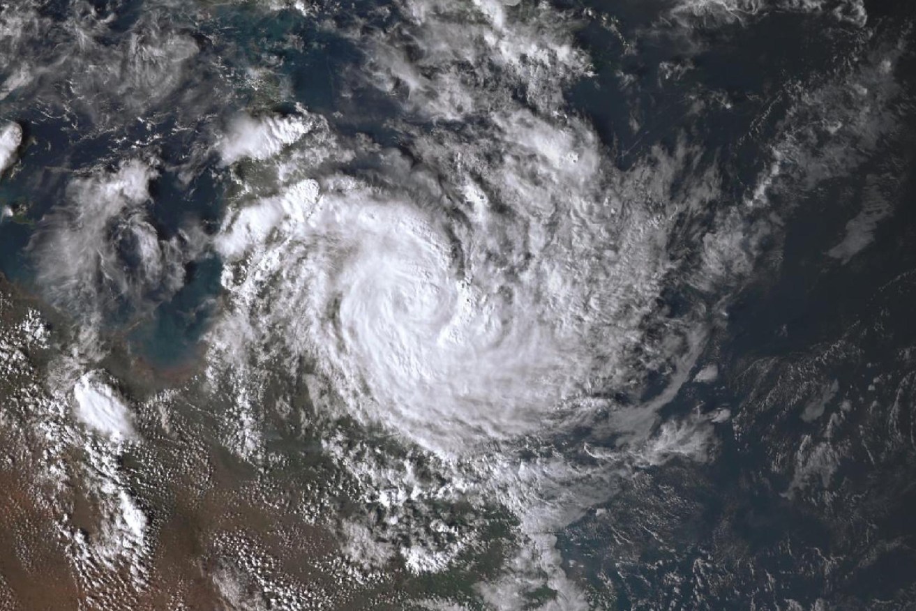
Ex-Tropical Cyclone Megan sweeps through inland NT
Residents of remote NT communities are assessing damage from Tropical Cyclone Megan. Photo: BoM
Major flooding and highway closures are expected as ex-Tropical Cyclone Megan continues to bring heavy winds and rain across the Northern Territory.
Some 700 residents in the town of Borroloola faced the worst of the cyclone on Monday evening when it crossed the coast on the south-western side of the Gulf of Carpentaria as a category 1 storm.
The community had been due to evacuate before the cyclone but RAAF aircraft were unable to land because of severe conditions.
Residents were instead told to shelter at the police station, health facility or dozens of dwellings capable of withstanding a category three system.
Tweet from @BOM_au
On Tuesday morning the Bureau of Meteorology said the system had weakened below cyclone strength and predicted it would continue to track west through inland parts of the NT over the next few days.
Borroloola residents were left mainly unscathed by the worst of the storm, with minor water damage and trees down.
“Overnight reports indicate that all residents are safe, with no injuries and in good spirits,” NT government emergency warning website SecureNT said.
“Minimal damage, primarily in the form of fallen trees, was reported within the community.”
The Bureau of Meteorology’s Shenagh Gamble said areas in the Barkly region, including Tennant Creek, should brace for large rainfall totals of 80 to 200mm.
“The conditions could change very quickly and deteriorate very quickly … rivers and creeks could rise rapidly with these rainfall amounts,” she said on Tuesday.
Chief Minister Eva Lawler said it was likely the Stuart Highway would be closed as the severe weather rips through the territory.
“There is a strong possibility with the amount of rain that we’ve seen … that there could be a closure of the Stuart Highway again,” she said on Tuesday.
She said NT government departments were working on contingency plans to ensure supplies would be well-stocked.
The McArthur River catchment has been forecast to exceed major flood levels on Tuesday or Wednesday.
Defence force personnel remain on standby to assist with recovery efforts.
Six-hourly rainfall totals between 80 to 150mm are likely, with a 24-hourly rainfall total of up to 200mm and wind gusts of more than 90km/h.
The cyclone warning zone stretches hundreds of kilometres along the coast of the Gulf of Carpentaria.
Almost 600mm of rain fell at Groote Eylandt over the weekend as the severe weather system moved over the remote island communities.
The wharf on the GEMCO manganese mine was damaged by one of its ships carrying manganese and fuel.
NT police said there was no leakage and authorities were working to remove the ship from the wharf.
A tropical low is also hanging off the West Australian coast, though forecasters say it’s likely to move west away from land throughout the week.
-AAP