What the MH370 search has uncovered so far

ATSB/Fugro
Investigators searching for the wreckage of MH370 “remain optimistic” they will discover its final resting place before the search concludes.
To date, just one part of the missing Malaysian Airlines plane has been positively identified – a flaperon wing component that washed up on a beach at Reunion Island.
It seemed to indicate the plane had disintegrated, but the final moments of the crew and passengers still remain unknown.
• Search for MH370 reveals second shipwreck in Indian Ocean
• Latest MH370 theory goes against logic
• MH370 passengers alive and ‘held captive’: theory
More than 80,000 square kilometres of the seafloor were searched by investigators, led by the Australian Transport Safety Bureau (ATSB), and an additional 40,000 square kilometres are yet to be searched before the program ends in June 2016.
“We remain optimistic,” MH370 operational search program director Peter Foley told The New Daily.
“There is still a large area to search between now and then and our discovery of two shipwrecks has shown that we have the right people and the right equipment out there looking.
“The scale of this search is unprecedented, and it is creating a very detailed picture of the seafloor in this area.”
Malaysian Airlines flight MH370 carrying 239 passengers from Kuala Lumpur to Beijing on 8 March 2014 lost contact with air controllers less than an hour after takeoff. Its pilots made no distress call.
Despite an extensive Australian-led search of the southern Indian Ocean, no trace of the aircraft was found until the discovery of the barnacle-encrusted flaperon on Reunion Island, more than 3,700km (2,300 miles) away from the main search site, in July 2015.
French investigators confirmed the aircraft wing part came from the missing Malaysian Airlines Boeing 777, after one of three numbers found on the flaperon was formally identified by a technician from Airbus Defense and Space (ADS-SAU) in Spain, which made the part for Boeing.

Search teams encountered demanding conditions throughout the search. Photo: James Hancock
As of December 2015, the cost of the underwater search – just one part of the investigation – was expected to total up to $180 million, about $60 million of that alone coming from the Australian government.
But in absence of a plane, there were some other stunning breakthroughs.
Shipwrecks uncovered one century later
The search area, along a long narrow arc in the southern Indian Ocean about six days’ sail from the nearest port, was previously uncharted waters.
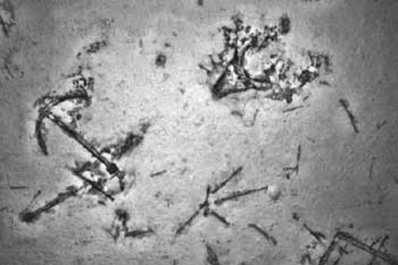
Among the geological discoveries were two shipwrecks, both thought to be from the 19th century.
Imagery captured in May 2015 by an autonomous underwater vehicle (AUV), showed coal, an anchor, and an array of debris, thought to be from a 19th century merchant sailing ship.
Then, late last year, sonar identified other man-made objects resting on the sea floor.

The ‘7th arc’, in the southern Indian Ocean, is where MH370 is believed to have exhausted its fuel and begun descending. Photo: Geoscience Australia
Experts at the Western Australian Museum Shipwreck Galleries reviewed the images returned by the AUV, and said it was likely to be a steel or iron sailing vessel from the turn of the 19th century.
Pioneering imagery of the seafloor
Crews are looking for MH370 in an area around Broken Ridge, a massive linear, mountainous sea floor structure that was once the border between two tectonic plates.
High-resolution imagery taken throughout the search had “revealed many geological features – in the form of seabed structures – for the first time”, Geoscience Australia environmental geoscience division chief Dr Stuart Minchin told The New Daily.
Although there had not been any groundbreaking discoveries, the data reaffirmed what scientists had already believed to be true.
Massive ridges six kilometres in width and 15km in length, bulging 1.5km above the previously known seabed, and 400m high volcanoes were among the areas able to be examined in greater detail.
“The survey data currently being acquired in the search for MH370 is some of the first high-resolution data available for these areas,” Dr Minchin said.
As little as 10 to 15 per cent of the ocean was previously mapped to this resolution.
Lack of wreck leaves hope for some

Ship debris found in May 2015, nearly 4km down on the seafloor. Photo: ATSB/Fugro
In early January, families of the Chinese passengers who disappeared with MH370 published a theory on the plane’s whereabouts which seemed to go against all that was known of the mysterious loss.
In absence of a wreckage, they proposed pursuing the possibility their loved ones were still alive and being held prisoner. They urged governments around the world to offer their captors amnesty.
In a statement to The New Daily, they declined to name the location they believed the passengers and crew were being held as it could “put them at grave risk”.
“We wish to give the captors a way out. We wish to offer them amnesty in return for the release of the family members,” the families said.
At the time, the Joint Agency Coordination Centre, the Australian body coordinating local search efforts, said any theories suggesting the plane was anywhere other than the current search area were “not supported by known facts or careful analysis”.


Twelve jurors selected in Trump hush-money trial